Method01 / 04
Two technologies, every site.
Electromagnetic induction finds metallic conductors; ground penetrating radar finds the rest. We use both on every locate, because either one alone misses targets the other catches.
Tyler · Longview · Lufkin · East Texas
Subsurface utility locating, GPR concrete scanning, drone LiDAR, and bathymetric mapping — under one crew, registered to one coordinate system. So what's above the dirt and what's below it line up.
What we do
Most subsurface jobs need more than one technology. We bring electromagnetic, GPR, sonar, and aerial LiDAR — and tie the results into a single, registered deliverable instead of three disconnected reports.

Lone Star 811 stops at the meter. We mark the rest — private power, water, gas, comms, sewer laterals, irrigation, and fiber on your property.
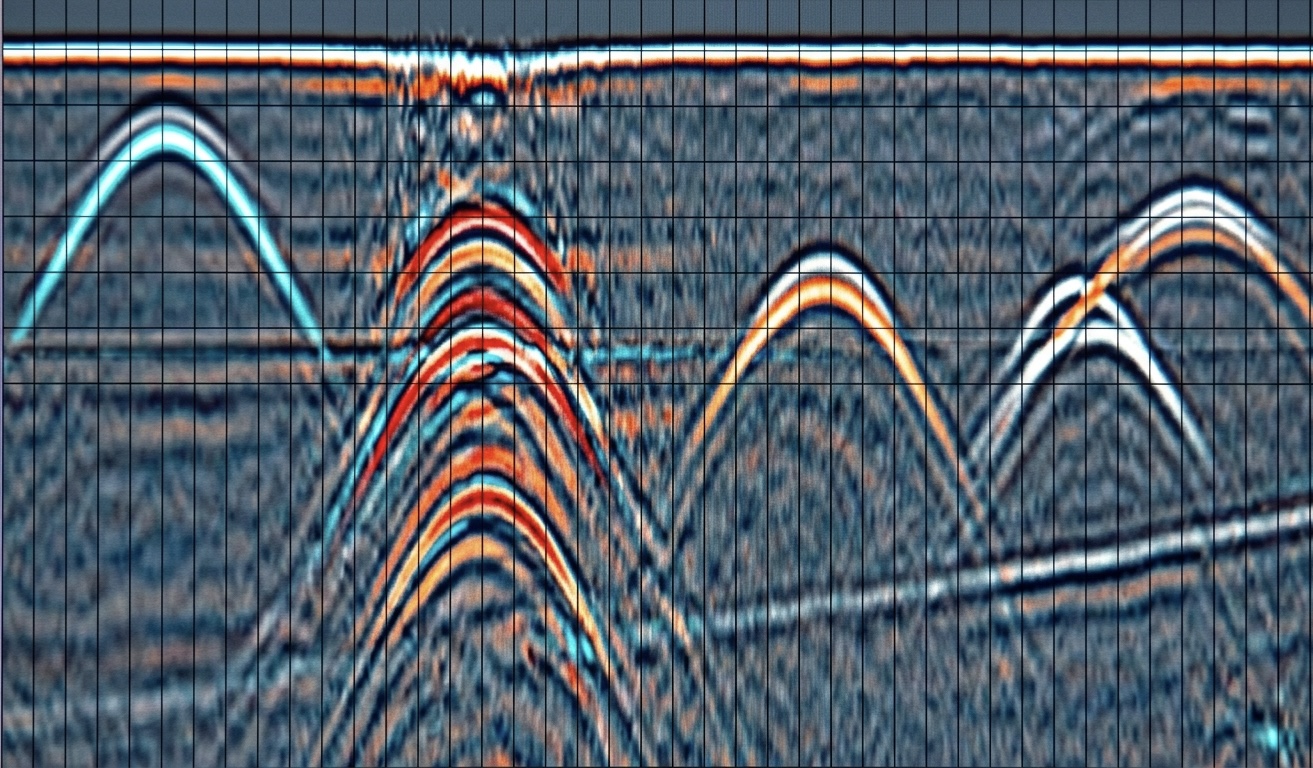
1.6 GHz GPR scans for rebar, post-tension cables, conduits, voids, and slab thickness — so cores, cuts, and anchors land where you want them.
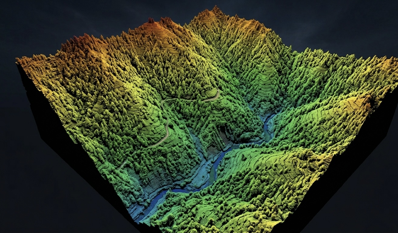
FAA Part 107 drone LiDAR, photogrammetry, and topographic mapping. Survey-grade point clouds, contours, and orthomosaics — delivered as the formats your engineers already use.

Dual-frequency sonar plus RTK GPS to measure water depth and the soft sediment above hard bottom. Know how much to dredge — to the cubic yard.
By the numbers
of utilities on a typical site are private and unmarked by 811
GPR frequency for concrete — sees rebar, conduit, post-tension cable
horizontal accuracy on RTK-corrected aerial and bathymetric work
typical response from quote request to crew on site
How we work
We're a Tyler-based outfit run by people who've been hit with surprise-utility tickets and over-budget dredge bills. Four principles drive how we run a job — they're what we'd want from a contractor on our own property.
Electromagnetic induction finds metallic conductors; ground penetrating radar finds the rest. We use both on every locate, because either one alone misses targets the other catches.
Paint disappears in a week. Every job leaves with photo documentation, reference measurements, and — when scope warrants — GPS-tagged digital sketches your team can pull up next year.
We register subsurface locates and aerial topo to the same coordinate frame. What's above the dirt and what's below it land in the same drawing instead of in three different binders.
Most calls get scheduled within 24 hours. Emergencies, struck-line situations, and night-shift coring get prioritized — we keep equipment loaded and ready.
Service area
East Texas — Tyler, Longview, Marshall, Lufkin, Nacogdoches, Texarkana, Athens, Henderson, Palestine, and surrounding counties.
Get a quote
Email a job address, scope, and any drawings or aerials you have. Most quotes go out the same business day.