GeoSpatial Services
A digital twin of every acre you touch.
FAA Part 107 drone LiDAR, photogrammetry, and topographic mapping. Survey-grade point clouds, contours, and orthomosaics — delivered as the formats your engineers already use.
Overview
What you get when you book.
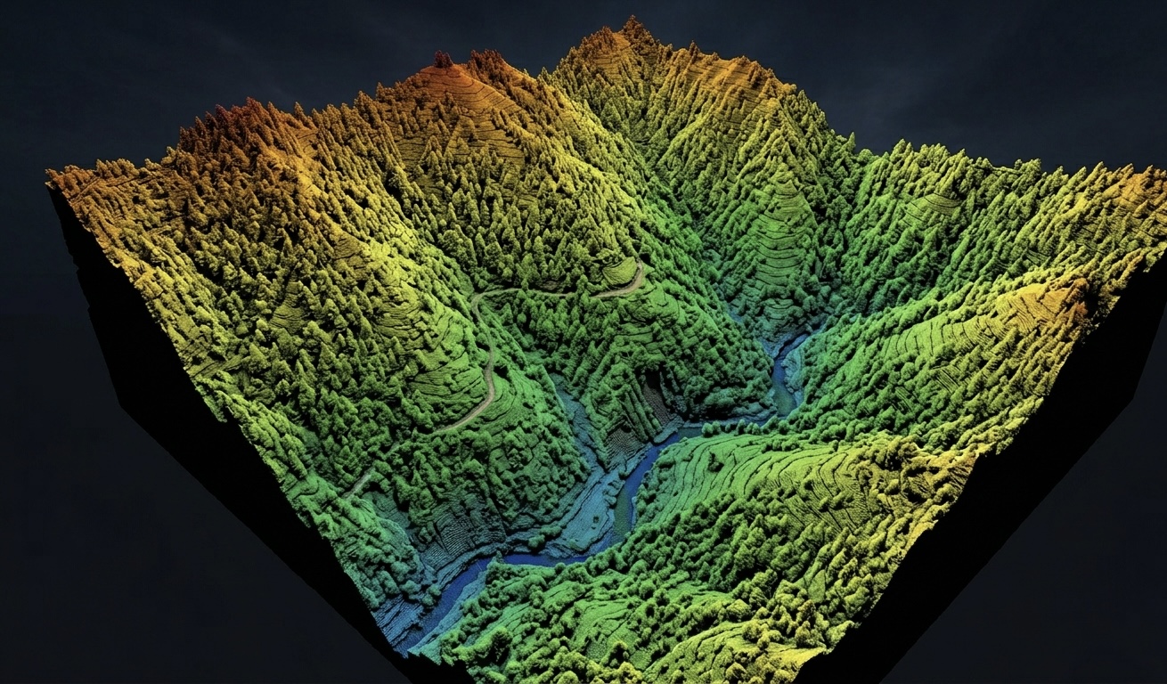
Our airborne LiDAR sees through brush and canopy to model bare-earth topography. Photogrammetry produces 2 cm GSD orthomosaics for measurement and as-built records. We tie ground control with RTK, deliver to Texas State Plane (NAD83 / NAVD88) by default, and overlay our underground locates onto the same coordinate system — so what's above and what's below align.
Capabilities
Equipment & methods
- 01FAA Part 107 certified pilot in command
- 02Drone LiDAR (vegetation penetrating)
- 03Photogrammetry and orthomosaic generation
- 04RTK ground-control and PPK workflows
- 05Topographic mapping and contour generation
- 06As-built documentation and volume calculation
Applications
When this service fits
- 01Site planning and civil design
- 02Stockpile and earthwork volumetrics
- 03Vegetation encroachment on power lines
- 04Right-of-way and easement documentation
- 05Pre- and post-construction comparison
- 06Floodplain and drainage analysis
Deliverables
What leaves with you when we leave.
LAS / LAZ classified point cloud
GeoTIFF orthomosaic and DSM / DTM
1-ft and 2-ft contour vectors (DWG / SHP)
PDF map atlas at requested scales
Optional 3D mesh and KMZ for stakeholders
Pricing
Plain-talk rate sheet.
Larger acreage, repeat-flight monitoring, and engineering deliverables quoted per scope. We carry $2M aviation liability and file LAANC authorizations on your behalf when needed.
Pair with
Other services we run
Get a quote
Tell us where you're digging.
Email a job address, scope, and any drawings or aerials you have. Most quotes go out the same business day.